White Pass is the pass Washington riders fall back on. When Chinook and the North Cascades Highway gate shut for the winter, US-12 over White Pass usually doesn't. It's the lowest of the state's major east-west crossings at 4,500 feet, and WSDOT keeps it open and plowed through the winter instead of closing it outright. That doesn't mean it rides the same in January as it does in July.
What "year round" actually means
Unlike Chinook Pass or SR-20, there's no seasonal gate here. US-12 is a maintained highway 24/7, weather permitting, and WSDOT plows and treats it through the winter rather than closing it. Winter closures happen, but they're the exception (avalanche control work or a bad storm) rather than the rule.
WSDOT requires chains on trucks over the pass starting November 1, which tells you plenty about what conditions look like by then. Always check WSDOT's White Pass page for current conditions rather than assuming a maintained road means a dry one.
Why riders default to this route
- It's the reliable option. When the closure-gate passes are shut for the season, this is the crossing that's actually still there.
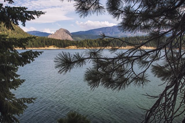
- Rimrock Lake. The stretch along the lake, with Kloochman Rock in the background, is one of the better photo stops on this side of the Cascades.
- Less elevation than Chinook. At 4,500 feet it doesn't get quite as cold as its neighbor, though it's still a real mountain pass.
What to actually watch for
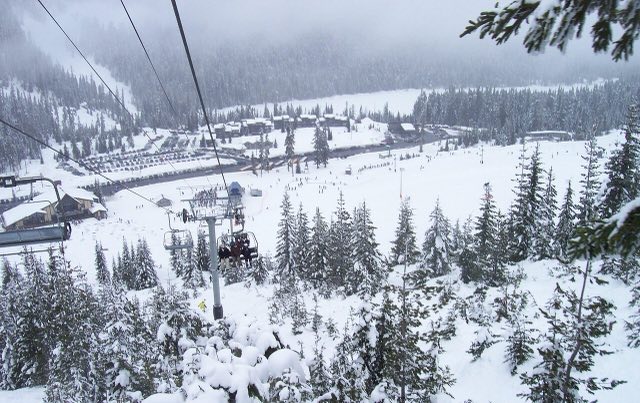
White Pass Ski Area sits right at the summit, which tells you how much snow actually falls here. The road being open doesn't mean the surface is dry, especially early or late in the day when overnight melt refreezes.
- Compact snow and ice, not closures. The risk here shifts from "is it open" to "what's the surface like," especially shoulder season mornings.
- Fog around Rimrock Lake. Cold water sitting next to a highway produces localized fog that can sit in low spots even on a clear day elsewhere on the route.
- Truck traffic and chains. This is a working freight corridor as much as a scenic one. Expect trucks running chains in winter conditions.
Best way to plan the ride
Because this pass rarely gives you a hard yes-or-no gate status, the real question is always surface condition and temperature at the summit versus what you're seeing down in Packwood or Naches. That's the elevation-aware check MotoCast handles. Plug in the route and it scores conditions along the actual climb, not just whichever town has the nearest forecast.
The small town on the west side of the pass has the last real cluster of gas, food, and lodging before the climb. Worth fueling up here regardless of which direction you're headed.