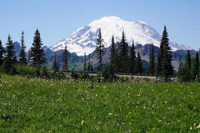
SR-410 over Chinook Pass is the ride Puget Sound riders point their bikes at the moment it reopens for the season. It climbs out of the White River valley, breaks above the treeline near Tipsoo Lake with Mount Rainier filling the whole view, then drops down the dry side into the Naches valley. Half the year none of that matters, because the pass is gated shut.
Is it even open right now?
Chinook Pass and its neighbor Cayuse Pass close together every fall and don't reopen until late spring. The old rule of thumb is a November closure and a mid-May reopening, but the last couple of seasons haven't followed it closely. The 2025 to 2026 season closed on October 24 and didn't reopen until May 22, just ahead of Memorial Day weekend. That's not really an edge case anymore. It's close to normal.
If you need a Cascades crossing while the gate is down, White Pass to the south rarely closes outright. Lower elevation, less scenery, but it's usually there.
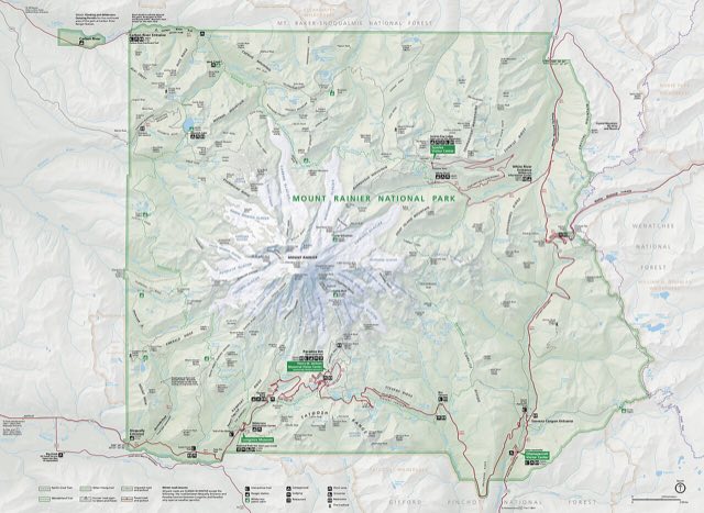
WSDOT and Mount Rainier National Park both post current gate status. Don't plan a ride around "it opens in May" without checking the actual date for that season. The gate can sit closed well past when the calendar says it should.
What actually closes it
- Avalanche risk. The corridor above the treeline holds snow that slides, and WSDOT won't open a road it can't keep clear.
- Limited emergency services. Park officials cite this as a standing reason for the closure, not just snow depth. Nobody's staffing a rescue response on that stretch in winter.
- Snow storage. There's only so much shoulder to pile plowed snow on before the road itself narrows to nothing. Some seasons that limit shows up before the snow does.
The pass makes its own weather
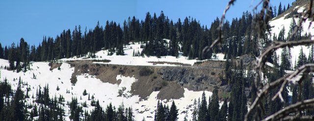
This is a genuinely different climate every few miles. The summit sits above the treeline, so there's nothing breaking the wind once you're up there, and Rainier itself is close enough to generate its own local weather regardless of what the forecast for Enumclaw or Yakima says. Snow can sit in the meadows near Tipsoo Lake well into summer in a heavy year, at the same time riders forty minutes down the hill are in short sleeves.
There's no windbreak and no tree cover if weather rolls in fast. Snow depth at the summit can run well into double digits in feet over the winter, and patches can linger into July in a heavy year. Pack for the pass, not for the valley you started in.
A half mile below the summit, with picnic tables and an easy 0.7 mile loop around the lake. Like the pass itself, the access road is only open June through October.
What to actually watch for
- Rockfall on the steep sections. The park's own guidance calls out the terrain specifically, not just the weather.
- Thick fog. It settles into the pass fast and doesn't announce itself from lower elevation.
- Wildlife on the road. Elk and deer move through this corridor, especially around dawn and dusk.
Best way to plan the ride
Treat Enumclaw and Yakima as two different weather questions, and the summit as a third. A clear forecast on either side of the mountain tells you nothing about what's happening at 5,430 feet with no tree line to soften it. That's exactly the gap MotoCast is built to close. Plug in the route and it scores conditions along the actual climb, not just the town at the bottom.
Riverside restaurant on the Naches River, the closest full-service stop to the park's east entrance. It's been a rider favorite on this road for more than 60 years.