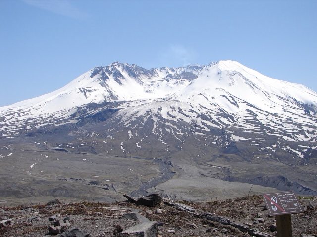
SR-504 is the ride everyone means when they say "let's go see St. Helens." It climbs out of the Toutle Valley, cuts through 40 years of blast-zone recovery, and normally ends at Johnston Ridge Observatory, staring straight into the crater. Right now it doesn't get you there. A landslide took out the road in 2023, and the fix is still underway.
Can you even get to the crater right now?
In May 2023, roughly 300,000 cubic yards of debris slid down a hillside above the highway near milepost 49, burying the road and destroying the 85 foot Spirit Lake Outlet Bridge. SR-504 has been closed between mileposts 45.2 and 51 ever since. WSDOT started permanent repair work in April 2026, targeting completion by fall 2026. Even once the road itself is fixed, the Forest Service still has to finish restoration work on Johnston Ridge Observatory before it reopens to visitors, so the full drive to the crater rim is likely out for a while yet.
Don't plan a ride around seeing the crater up close this season. Check WSDOT's SR-504 project page before you go. The road currently dead ends well short of Johnston Ridge, at the same gate used for the normal winter closure.
What's actually still open
- Mount St. Helens Visitor Center at Silver Lake. Down near I-5, well below the closure.
- Forest Learning Center and Elk Rock, Castle Lake viewpoints. Still deliver real views of the mountain from lower on the highway.
- Coldwater Lake Recreation Area, Hummocks Trail, South Coldwater Trailhead. All sit below milepost 45.2 and remain open.
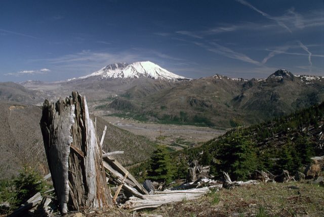
A paved trail along the ridge with a real view of the mountain across the valley, no observatory required. This is about as close as the current road gets you.
The normal seasonal closure, on top of all that
Even setting the landslide aside, this stretch of SR-504 closes for winter every year at the same milepost 45.2 gate. WSDOT and the Forest Service coordinate the closure each fall ahead of heavy rain, ice, and snow, and it gives crews time to clear downed trees and debris from the ditches before spring. It's worth remembering that once the bridge is rebuilt, the upper road will still follow this same seasonal pattern.
Much of this corridor still runs through the 1980 blast zone, where tree cover never fully grew back. There's less wind shelter here than a typical Cascades forest road, even on the sections well below the closure gate.
What to actually watch for
- Sparse tree cover. Long open stretches through the recovering blast zone mean more wind exposure than the forested approach on I-5 suggests.
- Elk on the road. The Toutle Valley's elk herds are a well known feature of the recovery area and cross the highway regularly.
- Changing closure status. Between the seasonal gate and the ongoing repair work, this is one road where checking current status matters as much as checking the forecast.
Best way to plan the ride
This is one of the rare rides where road status and weather are both moving pieces. Check WSDOT for the current closure point, then check conditions for whatever stretch is actually open. That second half is what MotoCast handles: plug in the route to Coldwater Ridge or wherever the gate currently sits, and score the real conditions along it.
Mile marker 19 in Toutle, in the old 19 Mile House building. Known locally for its cobbler and billed as the last beer for 70 miles, right along the Toutle River.