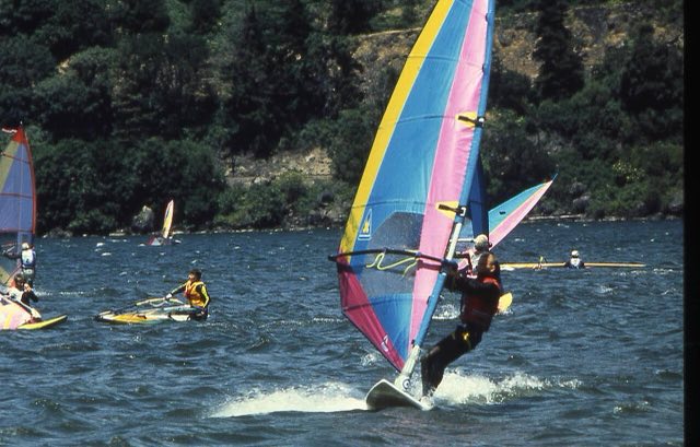
Hood River didn't earn the nickname "windsurfing capital of the world" for nothing. The Gorge is a sea-level gap cut straight through the Cascades, and in the warmer months it turns into a wind tunnel: cool marine air from the coast gets pulled through the gap toward the hot, dry interior, and the pressure difference between the two sides does the rest. That's great news if you're holding a sail. On a motorcycle, it's the single biggest thing to plan around here, more than rain, more than temperature.
Why is it so windy here?
It's basically a pressure gradient with a hallway to run through. Cool, marine-influenced air sits to the west, hot desert air builds over the Columbia Plateau to the east, and the Gorge is the lowest, most direct path between them. From May through September, that gradient produces strong westerly wind on nearly a daily basis, typically 10 to 20 mph with gusts into the 30s by afternoon. It's not a storm system you can wait out. It's the normal daily pattern for half the year.
The wind is thermally driven, which means it builds through the day and peaks in the afternoon as the interior heats up. Morning rides through the Gorge are noticeably calmer than the same stretch four hours later. If you're picking your window, pick the early one.
What the crosswind actually does
- Eastbound is a tailwind, westbound is a headwind. Neither is the dangerous one on its own. It's the transitions and the exposed spots where a steady wind turns into a sideways shove.
- Bridges and open stretches amplify it. Anywhere the terrain stops blocking the wind, gusts hit harder and more suddenly than what you felt a mile back in the trees.
- Cliff-edge curves get it worst. The old highway's switchback sections sit high and exposed, which is exactly where a gust can catch you mid-lean.
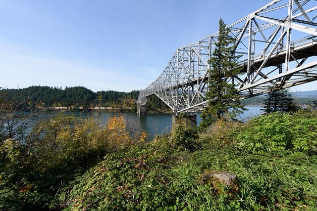
Right at the Bridge of the Gods in Cascade Locks, with a waterfront view of the river. It carries on the building's history as the Charburger, a Gorge landmark for over 60 years before it changed hands.
The common advice for riding in a crosswind is to relax your upper body and let the bike move a little under you rather than fighting every gust with a locked-out grip on the bars. Tensing up makes the correction worse, not better.
Where riders actually feel it
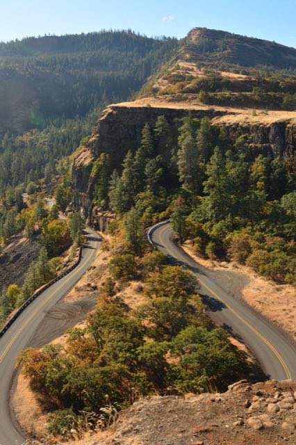
The Historic Columbia River Highway's Rowena Loops are the postcard shot of this drive, a set of switchbacks climbing a cliff face above the river with nothing around you but air. It's also about as exposed as this corridor gets. If you're going to hit one stretch with real attention paid to the wind report first, this is it.
The Gorge's most famous waterfall, right off I-84. From late May through early September a timed use permit is required between 9am and 6pm, even for motorcycles, and it has to be reserved ahead on Recreation.gov.
Best way to plan the ride
Most weather planning is about rain and temperature. Here it's about wind, specifically what time of day it picks up and which stretches expose you to it. That's the exact question MotoCast is built to answer. Plug in the route and it scores wind along the actual corridor, not just a general forecast for Portland or Hood River.